Imagine a future where we can predict natural disasters with alarming accuracy, mitigating their impact on communities and infrastructure. Sound like science fiction?
It’s closer than you think, thanks to innovative programs like the USGS Ecosystems’ Land Change Science Program. This cutting-edge initiative isn’t about simply tracking changes in our environment; it’s about understanding the intricate connections between land use, land cover, and the frequency and severity of natural hazards. By mapping these relationships, scientists are building powerful tools to safeguard public safety and prepare for the challenges of a changing planet.

Forecasting the Unforeseeable: USGS Climate Science Goals
The United States Geological Survey (USGS) has been at the forefront of understanding the dynamics of Earth’s systems, including the impacts of climate change. In its Climate Science Plan, the USGS outlines 12 goals aimed at characterizing climate change and associated impacts. These goals are grouped under three main science priorities, with a focus on understanding the processes and basic science of the climate cycle, its various physical and biotic components, and feedbacks among the carbon cycle, hydrologic cycle, ecosystems, and land cover changes.
Understanding the Dynamics of Earth’s Systems
The USGS has a long history of researching, monitoring, and assessing Earth’s systems to understand the processes and basic science of the climate cycle. This includes studying the interactions between the carbon cycle, hydrologic cycle, ecosystems, and land cover changes. By understanding these complex interactions, the USGS can better predict how climate change will impact various components of Earth’s systems, including ecosystems, landscapes, and resources.
Modeling Climate Change Impacts and Feedback Loops
Modeling climate change impacts and feedback loops is a critical component of the USGS Climate Science Plan. By developing and refining climate models, the USGS can better predict how climate change will impact various components of Earth’s systems. This includes modeling the impacts of climate change on ecosystems, landscapes, and resources, as well as the feedback loops that can amplify or mitigate these impacts.
Bridging the Gap Between Science and Decision-Making
The USGS recognizes that climate change is a complex and multifaceted issue that requires a coordinated approach to decision-making. To bridge the gap between science and decision-making, the USGS engages with stakeholders, including land management agencies, industry, the public, Tribes, and others. By providing science-based products and support services, the USGS can help inform decision-making and adaptation planning, ultimately reducing economic and ecological losses and societal disruption.
The Value of Ecosystems’ Land Change Science Program
The Ecosystems’ Land Change Science Program is a critical component of the USGS Climate Science Plan. This program focuses on understanding the impacts of climate change on ecosystems, landscapes, and resources, as well as the feedback loops that can amplify or mitigate these impacts. By studying the dynamics of ecosystem change, the USGS can better predict how climate change will impact various components of Earth’s systems, including ecosystems, landscapes, and resources.
Understanding the Rate and Impacts of Terrestrial and Subsea Permafrost Degradation
Permafrost degradation is a critical component of the Ecosystems’ Land Change Science Program. By studying the rate and impacts of terrestrial and subsea permafrost degradation, the USGS can better predict how climate change will impact various components of Earth’s systems, including ecosystems, landscapes, and resources. This includes understanding the impacts of permafrost degradation on infrastructure, ecosystems, and human communities.
Developing and Assessing Ice Sheet Models for Better Prediction of Sea-Level Rise
Sea-level rise is a critical component of the Ecosystems’ Land Change Science Program. By developing and assessing ice sheet models, the USGS can better predict how climate change will impact sea levels, including the impacts of ice sheet melting on coastal ecosystems and human communities. This includes understanding the feedback loops that can amplify or mitigate sea-level rise.
Preparing for Hazards: The USGS Coastal and Marine Hazards and Resources Program
The USGS Coastal and Marine Hazards and Resources Program is a leader in natural hazards research. This program focuses on understanding the impacts of multiscale hazards, including hurricanes and climate change, on coastal ecosystems and human communities. By studying the impacts of these hazards, the USGS can better predict how climate change will impact coastal ecosystems and human communities, including the impacts of sea-level rise and extreme weather events.
Studying the Impacts of Multiscale Hazards
The USGS Coastal and Marine Hazards and Resources Program studies the impacts of multiscale hazards, including hurricanes and climate change, on coastal ecosystems and human communities. By understanding these impacts, the USGS can better predict how climate change will impact coastal ecosystems and human communities, including the impacts of sea-level rise and extreme weather events.
Developing Science-Based Products and Support Services
The USGS Coastal and Marine Hazards and Resources Program provides science-based products and support services to inform decision-making and adaptation planning. This includes developing and refining climate models, as well as providing data and analysis to support coastal management and planning. By providing these products and services, the USGS can help reduce economic and ecological losses and societal disruption.
Expert Analysis and Insights
The USGS Climate Science Plan is a critical component of the USGS’s efforts to understand and predict the impacts of climate change. By studying the dynamics of Earth’s systems, the USGS can better predict how climate change will impact various components of Earth’s systems, including ecosystems, landscapes, and resources. This includes understanding the feedback loops that can amplify or mitigate these impacts.
Real-World Applications and Examples
The USGS Climate Science Plan has real-world applications and examples across various sectors, including land management, coastal management, and resource development. By providing science-based products and support services, the USGS can help inform decision-making and adaptation planning, ultimately reducing economic and ecological losses and societal disruption.
Engaging with Stakeholders
The USGS engages with stakeholders, including land management agencies, industry, the public, Tribes, and others, to provide science-based products and support services. By understanding the needs and concerns of these stakeholders, the USGS can better inform decision-making and adaptation planning, ultimately reducing economic and ecological losses and societal disruption.
Geological Groundwork: Measuring Risk and Vulnerability
The U.S. Geological Survey (USGS) plays a pivotal role in understanding the nation’s geological landscape and assessing the risks associated with various natural hazards. As part of its mission, the USGS employs cutting-edge technologies and methodologies to measure risk and vulnerability in various ecosystems.
Remote Sensing: A Bird’s-Eye View of Changing Landscapes
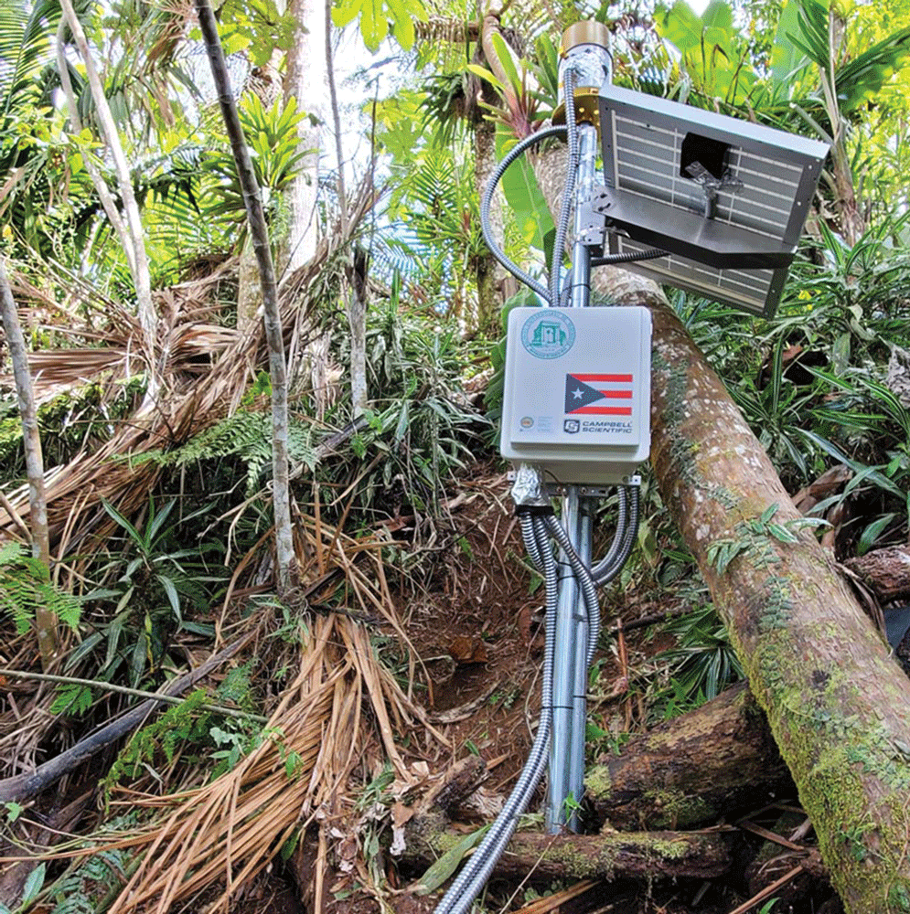
One of the key tools used by the USGS is remote sensing technology, which provides a bird’s-eye view of changing landscapes. By utilizing satellite and aerial imagery, researchers can gather data on land cover changes, monitor vegetation health, and detect early signs of natural hazards such as wildfires and landslides.
For instance, the USGS’s Landsat 8 satellite has been instrumental in monitoring land cover changes across the country. By analyzing the satellite’s data, researchers can identify trends and patterns that indicate areas of high risk or vulnerability.
Furthermore, the USGS has developed advanced algorithms and machine learning techniques to analyze remote sensing data. These tools enable researchers to quickly and accurately identify patterns and anomalies in the data, which can inform decision-making and mitigate risks.
Permafrost Peril: Tracking the Melting of Ground Ice
Another critical area of research for the USGS is the study of permafrost, which is ground ice that remains frozen for two or more consecutive years. As the climate continues to warm, permafrost is melting at an alarming rate, leading to a range of consequences, including soil instability and altered ecosystems.
The USGS has developed sophisticated models to track the melting of permafrost, which enables researchers to predict areas of high risk and vulnerability. By analyzing data from sensors, satellite imagery, and field observations, researchers can identify the extent and rate of permafrost melting.
For example, a recent study by the USGS found that permafrost is melting at a rate of 1-2 meters per decade in some areas of Alaska. This research highlights the urgent need for policymakers and stakeholders to take action to mitigate the impacts of permafrost melting.
Coastal Conundrums: Adapting to Sea Level Rise and Extreme Weather
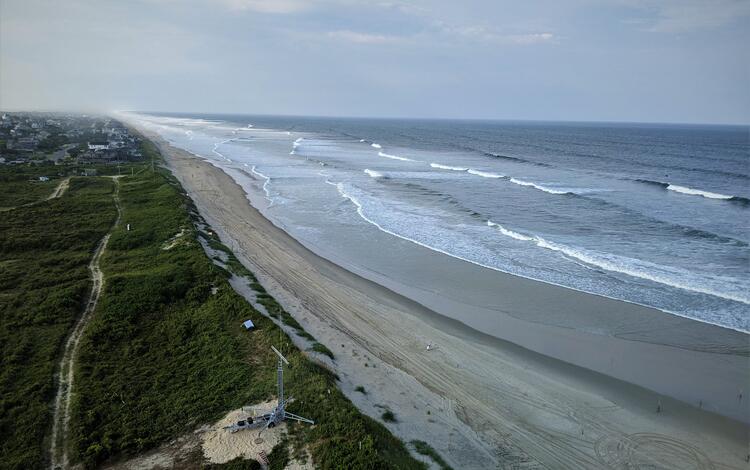
The USGS is also at the forefront of research on coastal hazards, including sea level rise and extreme weather events. By studying the impacts of these hazards, researchers can inform decision-making and develop strategies to adapt to these changing conditions.
For instance, the USGS’s Coastal and Marine Hazards and Resources Program studies the impacts of sea level rise on coastal ecosystems and communities. By analyzing data from sensors, satellite imagery, and field observations, researchers can identify areas of high risk and vulnerability.
Furthermore, the USGS has developed advanced models to predict the impacts of sea level rise and extreme weather events. These models enable researchers to simulate various scenarios and identify the most effective strategies for adaptation and mitigation.
Protecting Communities and Infrastructure: Science in Action
The USGS’s research has far-reaching implications for communities and infrastructure across the country. By applying the knowledge and expertise gained from its research, the USGS helps to protect communities and infrastructure from natural hazards.
Predicting and Mitigating Wildfire Risks
One area of focus for the USGS is predicting and mitigating wildfire risks. By studying the conditions that lead to wildfires, researchers can develop strategies to prevent these events and protect communities and infrastructure.
For instance, the USGS’s Wildland Fire Science Program studies the interactions between fire, climate, and vegetation. By analyzing data from sensors, satellite imagery, and field observations, researchers can identify areas of high risk and develop strategies to prevent wildfires.
Furthermore, the USGS has developed advanced models to predict the behavior of wildfires and simulate various scenarios. These models enable researchers to identify the most effective strategies for mitigation and prevention.
Navigating Water Security Challenges in a Changing Climate
The USGS is also at the forefront of research on water security challenges, including droughts, floods, and water quality issues. By studying the impacts of these challenges, researchers can inform decision-making and develop strategies to adapt to these changing conditions.
For example, the USGS’s Water Resources Mission Area studies the impacts of droughts on water resources and communities. By analyzing data from sensors, satellite imagery, and field observations, researchers can identify areas of high risk and vulnerability.
Furthermore, the USGS has developed advanced models to predict the impacts of droughts and floods. These models enable researchers to simulate various scenarios and identify the most effective strategies for adaptation and mitigation.
Building Resilience: USGS Tools for Climate Adaptation
The USGS offers a range of tools and resources to help communities and infrastructure build resilience in the face of climate-related challenges. By applying the knowledge and expertise gained from its research, the USGS helps to protect communities and infrastructure from natural hazards.
For instance, the USGS’s Climate Adaptation Science Center provides resources and tools to help communities adapt to climate-related challenges. By analyzing data from sensors, satellite imagery, and field observations, researchers can identify areas of high risk and develop strategies to prevent natural hazards.
Furthermore, the USGS has developed advanced models to predict the impacts of climate-related challenges. These models enable researchers to simulate various scenarios and identify the most effective strategies for adaptation and mitigation.
Conclusion
In conclusion, the USGS’s Land Change Science Program is a beacon of hope in the quest to mitigate the devastating impacts of natural hazards on human populations. By harnessing the power of advanced technologies and scientific expertise, this program has been instrumental in providing critical insights into the complex dynamics of land change and its far-reaching consequences. From monitoring land surface changes to predicting the likelihood of catastrophic events, the program’s multifaceted approach has been instrumental in safeguarding public safety and informing data-driven decision-making.
The significance of this program cannot be overstated. As the frequency and severity of natural disasters continue to escalate, the need for proactive and evidence-based strategies to mitigate their impacts has never been more pressing. By providing a comprehensive understanding of the intricate relationships between human and environmental systems, the Land Change Science Program offers a powerful tool for policymakers, emergency responders, and stakeholders to prepare for and respond to hazards. As we look to the future, it is imperative that we continue to invest in and expand this program, harnessing its potential to save lives, reduce economic losses, and foster a culture of resilience in the face of uncertainty.


